
Virtual Lands End to John O’Groats....Week 2
- Cathy MacTaggart
- Apr 14, 2020
- 4 min read

Friday 27 March. 29 Miles. Moretonhampstead-Broadhembury. Total 150 miles
Today’s actual bike ride was cold – out into a cold headwind to Colne Engaine from the north-east, but back with a fair tailwind.
The virtual bike ride traversed the last hill on Dartmoor and headed down across the plain to Exeter (which is also on a hill), on the way to Broadhembury. Broadhembury is a picturesque village, on the edge of the Blackdown Hills, nestled into a horseshoe shaped valley. Sir Cedric Drew, influential MP for Honiton (1931-55), who ensured it remained undeveloped, with the majority dwellings being cob and thatch cottages.
Cob is an ancient building material with a long life-span, used since prehistoric times. Cob means to beat or strike, which is how it is applied to a wall – either slapped on to a vertical surface or stamped on a flat one. Traditionally it is made from clay subsoil, with sand, straw, and manure, trampled by oxen. It is the straw that gives the tensile strength. This is laid in courses, trodden in place, by a process called cobbing. Each course has to dry prior to the next being laid, meaning it is a time consuming construction method. Walls of cob houses are often 2 feet wide, with deep-set windows and are consequently warm in winter and cool in summer because of excellent thermal mass. Fire cob (cob made without straw) is used for building chimneys and fireplaces, but has less tensile strength.
"Cob stitch" repair on old traditional cob cottage in Devon, England

Monday 28 March. Broadhembury-Langport 28 miles. Total 178 miles
This route goes up over the Blackdown Hills, meaning there is flat riding across the plateau, before descending to the Somerset Levels to Langport.
Langport is accessed from the southwest along Bow Street – a straight roman road – via a bridge over the River Parrett. It is alleged that the road was so well built, that houses facing this roman road lean backwards. The road foundations have kept the front walls at the correct height, but the rear foundations, based on the wet Somerset levels, have ‘drooped’. The Norman church of St Mary’s also boasts a window on its south aisle that was designed by Edward Byrne-Jones and made in William Morris’s workshop.

A significant resident of Langport was the long-time editor of The Economist, Walter Bagehot (1826-77). His family ran the 19th Century Stuckey & Bagehot trading company, and the Stuckey’s bank which was so secure, that it had the second biggest banknote circulation (biggest was the Bank of England). Ultimately via mergers, Stuckey’s bank was absorbed into the National Westminster Bank..
Tuesday 29 March. Langport- Chew Stoke 29 Miles. Total 207 miles.
This day’s ride goes through Street and Glastonbury. Here there is a large community of alternative lifestyles. When Jim and I rode through, we were much more interested in the old-fashioned bakers. The baker was filling his van with baked goods, before setting out on his delivery round. There was a falconer waiting outside, with his falcon. In conversation with him, I discovered the local pigeons had developed considerable skills as marauders – waiting for the baker to place a tray in the van, and flying in to steal whole pies before he could come out again with the next trayload. The falconer had a regular hour’s contract on all delivery days, to fly his bird up and down the main street, protecting the baker’s wares.


From Glastonbury, the route heads northeast, before climbing over the Mendips to Compton Martin. This village’s main claim to fame is that it is a site of special scientific interest (SSSI) because it has a red ochre mine. This mine contains haematitic iron ore (red ochre) used in making paints (I suspect watercolour, rather than household emulsion), and also hosts a colony of greater horseshoe bats, thus is protected under various bits of environmental and wildlife legislation. Chew Stoke was just a little further on.
Thursday 24 March Chew Stoke-Tintern 36 miles. Total 243 miles
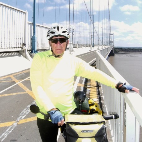
This would be a day of ascents and descents – up to river and motorway bridges and down along the riverside. National Cycle Route 41 follows the west bank of the River Avon giving great views of the Clifton Suspension Bridge, and idyllic riding on riverside cyclepaths. Then the route ascends to cross the River Avon on a separate cycle path along the M5 bridge, then skirts the banks of the River Severn, to cross this river on the M48 cyclepath.


After this the roads quickly return to traversing beautiful countryside. The route starts hammering downhill and suddenly the ruins of Tintern Abbey appear on your right-handside. The road starts heading uphill quite sharply, and The Old Tintern Station tea room comes into view, with a tiny, quiet campsite alongside. Here Jim and I spent a wonderful evening camping, cooking our dinner on the tearoom tables, and sleeping in our tent (even if the campground was on a slope, so we had to be very careful where we positioned our sleeping bags).


Second week of LEJOG completed. More varied, starting to enjoy riding longer distances.


Comments